

Places in the Empolese Valdelsa
Filter/Filtra
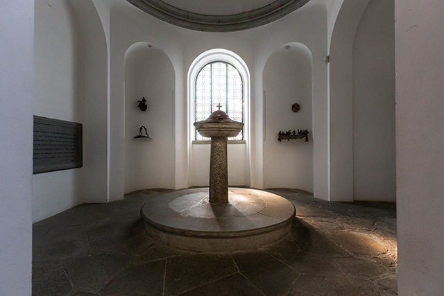
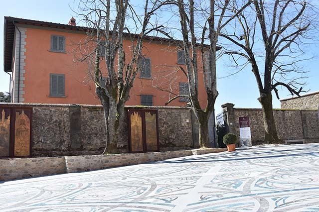
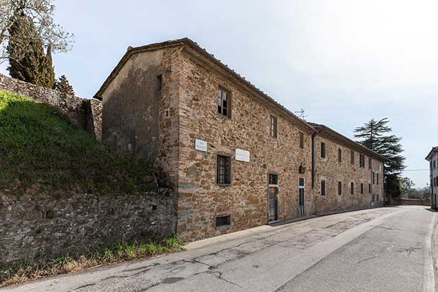
Santa Croce was the parish church of notary ser Piero da Vinci’s family. It was here that his son Leonardo, not legitimate, but firstborn, was baptized in April 1452. Of the church frequented by the da Vinci family, nothing remains but the title: the current building, in fact, is the result of the radical reconstruction of the ancient Vinci church that originally belonged to the Counts Guidi. Preserved inside, however, is the ancient baptismal font where the baptismal ceremony for the newly born Leonardo took place. In the community of Santa Croce, Leonardo’s family had several farms, of which traces remain today in the names of some of the farmhouses dotting the Vinci hills.
Collegalli, which Leonardo drew as a small castle, was in fact originally one of the fortified villages of the Val d'Egola and belonged, at the beginning of the 12th century, to the noble Gherardeschi family. The traces of the ancient castle have been obliterated by the construction, on the same site, of the Villa Strozzi, built at the beginning of the 19th century, used today as a structure for reception. In the area, we still find the toponyms of two of the three parish churches that were dependent on the castle of Collegalli (San Vito and San Paolo), recognizable in the two small rural chapels still maintaining their later forms, in the tiny homonymous farms in the administrative district.
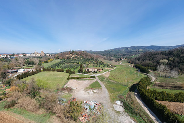
Collegonzi, one of the ancient castles that the Counts Guidi owned in the area of Greti, must have appeared in the time of Leonardo as an open village, a cluster of houses at that point lacking in ancient fortifications. It was in this form, in fact, that it was drawn by Leonardo in the famous bird's eye view map from the Windsor Castle collection. Leonardo knew Collegonzi well; he described the famous “cut bank,” a part of the right bank of the Arno affected by the erosive action of the flow of water, based on which Leonardo had matured his observations about the origin of the "nichi", the marine fossils present in large quantities in the Pliocene levels of the Collegonzi hills.
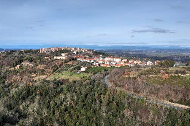
Empoli was born at the beginning of the 12th century on the initiative of the noble Guidi family. The document describing what was a genuine, ex novo creation of a settlement around the parish church of Sant’Andrea dates to the year 1119. But the beautiful, quadrangular, walled village Leonardo depicted in his bird's eye view in the Windsor Castle collection shows nothing remaining from the ancient Guidi castle. The walls of Empoli depicted in Leonardo’s drawing were constructed starting in 1466, with contributions from the most talented military architects then at the service of the Medici: Antonio il Vecchio and Giuliano da Sangallo.
Carlo Pedretti earned an international reputation as one of the greatest experts on Leonardo da Vinci of the 20th century. He established a cultural foundation in Lamporecchio, whose seat is located in the villa that once was his private residence. In the nearby village of Vinci the foundation has also recently opened a cultural and exhibition centre, the Villa Baronti-Pezzatini. The mission of the Pedretti Foundation is to conserve for posterity the scholarly work that was conducted by Prof. Pedretti and to promote and sponsor continuing research in the areas that he pioneered.
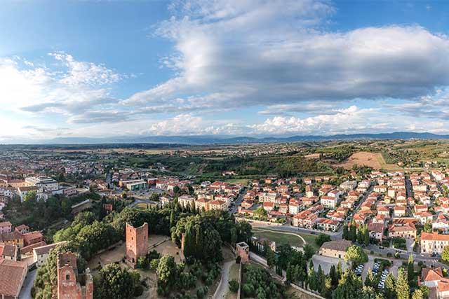
Leonardo represented Fucecchio in the forms it had reached between the end of the 13th century and the beginning of the 14th century, when the villages that grew up outside the gates of the most ancient castle, founded by the Counts Cadolingi, were surrounded by walls punctuated with wall towers, of which some were angular, as seen in Leonardo’s drawing. On the top of the hill, we can recognize the profile of the Rocca Fiorentina, built around 1325 by the dominating city. Today four of the seven towers of the Rocca are preserved in the park of Palazzo Corsini, site of the Museum of Fucecchio.
Gambassi has a long history. Originally it was one of the Valdelsan castles that belonged to the Cadolingi, the counts of Fucecchio, but the turreted castle drawn by Leonardo corresponds to a second settlement, the castrum novum of Gambassi founded by the bishop of Volterra at the end of the 12th century. The castle structure, which had an elongated oval shape, can still be easily recognized within the regular texture of the narrow streets of the historic center. When Leonardo depicted Gambassi as a fortified center, well equipped with curtain walls and towers, the castle must have perfectly maintained the features of the foundation of the castrum Bishop Ugo designed ex novo in front of the old castle of the Counts Cadolingi.
The ancient Guidi castle of Granaiolo (12th century), strategically located on the border of the Elsa, became the object of strong attention by the city of Florence. Most of the information about the form of the castle drawn by Leonardo comes from written sources: in the 15th century it was surrounded by a defensive wall, while some houses were constructed of raw earth. The rapid degradation of these structures must have contributed to the cancellation of the castle, of whose toponym the trace remains today in the title of the Villa Pucci chapel, which preserves the memory of the castle church, Santa Maria al borgo vecchio (in the old village).
The Leonardian project of an artificial lake that was to be created just below the castle of Vinci is to be considered the only work Leonardo designed for his native land. Leonardo’s idea, represented on three different maps, provided for the creation of a basin fed by the waters of three brooks that descended from Montalbano, blocked off downstream by a barrage. The watercourses involved in this project, which we can recognize perfectly, had long been defended by the municipal authorities. It may have been a public project, probably related to the use of the mechanical force of water for driving the water wheels of the mills that dotted the valleys of the lands of Leonardo.
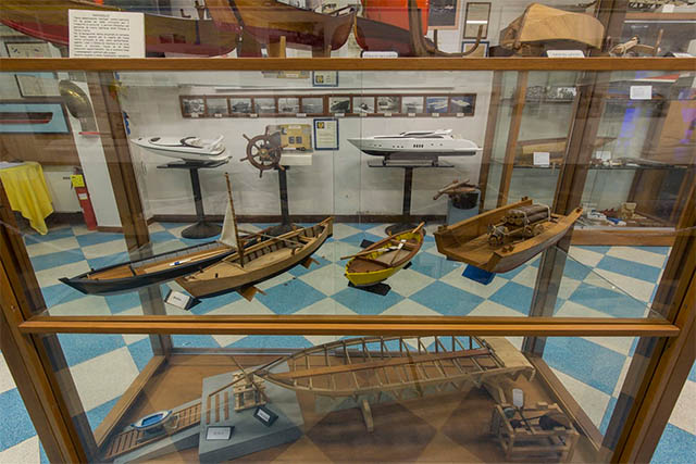
Leonardo lived along the banks of the Arno since boyhood, when he went down from Vinci to the town of Limite, on the right bank of the river. Here he had the opportunity to observe the typical boats for navigating the river, of the same type depicted in one of his folios in the Codex Atlanticus. On the banks of the Arno, Leonardo would also have been able to observe the master carpenters at work on the construction sites at Limite. The Limite exhibition center preserves the memory of the activity of the master hull workers,, which developed during the 15th century.
In Leonardo’s maps dedicated to the Valley of the Arno, we can clearly recognize the deep bend of the river that flowed along the settlement of Limite and the turreted village of La Castellina. These places have a very ancient origin, but Leonardo fixed in time the image of the Arno at the moment when the river's conformation had made possible the development of the two villages. La Castellina was still a castle surrounded by the walls with which it had been fortified during the Late Middle Ages. Limite was then on the way to development owing to the activities of the master hull-working craftsmen, then flourishing on the right bank of the Arno.
Lucardo’s origins date back to the Early Middle Ages, when one of the curtis of the noble Cadolingi family stood in this locality. The personages of the minor aristocracy who are mentioned in reference to the castrum of Lucardo, beginning from the mid-11th century, must have been linked with this powerful lineage. This small town of the Val di Pesa definitively entered the orbit of Florence after the events of the Semifonte War. The transformation into a country residence, on the initiative of the new Florentine owners, did not completely efface the original appearance of the castle, the form in which Leonardo represented it on one of its maps.
What distinguishes the figure of Leonardo as a man of science is surely the outstanding empirical character of his knowledge. One of his papers linking him to the years of his early youthful experience in Vinci is one on which he explicitly mentions the Mill of La Doccia di Vinci, alongside sketches of mechanisms for a water wheel. The place where the ancient mill mentioned by Leonardo stood still exists along the road that goes up from Vinci to Anchiano. A little further upstream is the well-preserved weir of the mill, in masonry terraced with steps, which recalls constructed items of the same type drawn by Leonardo.
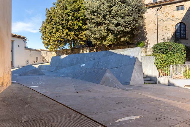
The square that, with Leonardo's starry dodecahedron, today welcomes visitors ascending to the castle is an invitation to enjoy the entire program of knowledge dedicated to Leonardo offered by the two venues of the Museo Leonardiano. The entrance of the new headquarters, Palazzina Uzzielli, coincides with the new Piazza Guidi, the work of contemporary artist Mimmo Paladino. Paladino’s symbols inspired by Renaissance geometry merge with the backdrops of Leonardo's landscapes, in an original and evocative contemporary urban space.
The village of Mommialla has been renovated now for some years, and today houses the facilities for the spa waters. In the mighty stone fortified houses of the village, we must recognize the physiognomy of the small fortified village Leonardo drew on one of his most famous maps. Actually the locality has very ancient origins: the early medieval village of Mommialla belonged to the bishop of Volterra. Of its oldest history, there remain traces in the tiny church of San Frediano, which is conserved as part of one of the local tourist complexes, a short distance from the village itself. The small church can be recognized by the cruciform loophole on the facade, a decorative element typical of the churches of the Valdelsa.
Around the year 1000, the locality of Montesumano was probably administered under the royal fiscal system. Beginning only from the 12th century, a castle is documented as standing on the hill of Monsummano, controlled by the Counts Alberti of Prato. The material traces of the Alberti castle are still perfectly recognizable, at the top of the cone-shaped elevation that overlooks the Fucecchio marshes. Despite the progressive abandonment of the site, at the end of the 15th century, Leonardo drew the castle of Monsummano still vaunting its defensive structures, clearly recognizable, both in the famous 1473 landscape and in one of Leonardo's maps depicting the Lower Valdarno.
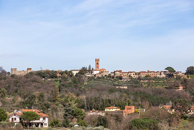
Montaione preserves the imprint of its origins within the fabric of its current building structure. In fact, its form has been that of a castle since the early 13th century, belonging to the de Monteaione family, a branch of the rural aristocracy closely linked to the imperial village of San Miniato. Leonardo drew Montaione as a turreted castle, the form in which he certainly saw it, and the same form in which it is represented in a rare, detailed watercolor from the 16th century, in which Montaione still has its walls complete, with all its wall towers and its two fortified gates, Porta Guelfa and Porta Fiorentina.
Montecarlo, a small but well-fortified town of the Valdinievole, was represented by Leonardo in the forms we can see today. In fact, it preserves perfectly the layout of the 14th-century castle, the Castrum Lucense, founded anew by the city of Lucca after the destruction by the Florentines. Subsequently it was called "Mons Caroli," Montecarlo, with clear reference to the young prince, son of the count of Luxembourg and lord of Lucca. The orthogonal layout of the new fortified village built at the foot of the Rocca del Cerruglio was typical for newly founded villages.