

-
Home

-
Places
- Metropolitan City of Florence
Municipality of Fucecchio
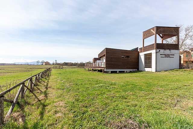
The center, based in Castelmartini (PT), deals with the research, protection, and promotion of the wetlands of the Fucecchio marsh. Leonardo knew this environment well, which he seems to have depicted in his famous 1473 Paesaggio (Landscape). The still body of water at the center of the drawing appears to be navigated by two forms of watercraft with curved bows, very similar to the marsh navicelli (small ships), which until last century transported men and goods from one end of the Fucecchio Marsh to the other. The center also organizes visits to the naturalistic area of Arnovecchio, the habitat developed in the particular place where one of the deep meanders of the river, depicted by Leonardo just before its rectification, once passed.
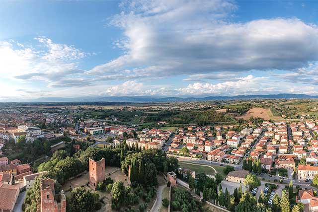
Leonardo represented Fucecchio in the forms it had reached between the end of the 13th century and the beginning of the 14th century, when the villages that grew up outside the gates of the most ancient castle, founded by the Counts Cadolingi, were surrounded by walls punctuated with wall towers, of which some were angular, as seen in Leonardo’s drawing. On the top of the hill, we can recognize the profile of the Rocca Fiorentina, built around 1325 by the dominating city. Today four of the seven towers of the Rocca are preserved in the park of Palazzo Corsini, site of the Museum of Fucecchio.
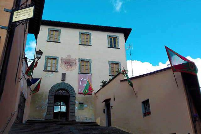
The 50-year anniversary of the Fucecchio Museum also falls in 2019, the year of Leonardo. For this occasion the museum has been enriched by a new permanent exhibition that will illustrate the formation of the medieval landscape around Fucecchio, an ancient Cadolingi castle on the Via Francigena that Leonardo depicted in one of his most famous maps, in the form it had reached during the 14th century, with the walled villages and the towered hill of the Rocca Fiorentina. Leonardo is the guiding theme of the exhibition Alle radici di un luogo leonardiano: una signoria e il suo paesaggio (At the roots of one of Leonardo’s places: a lordship and its landscape) with which the new permanent section opens. The transformations of the landscape, reconstructed with digital instruments, accompany the visitor through the centuries of the history of this "Leonardian place".
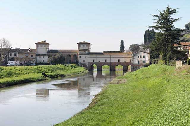
The Medici bridge at Cappiano has always held a special place in the history of the Cerbaie. During the early Middle Ages it was one of the stages of the Via Francigena. The resting place was called Aqua Nigra, indicating, at the time, the Usciana river, the only effluent of the Fucecchio marsh. The bridge, an obligatory crossing of the pilgrimage route, became strategic during the municipal period when the cities of Lucca and Florence faced off with each other in this area. At the end of the 13th century, the Cappiano bridge was fortified with a masonry tower, and it was in this form that Leonardo depicted it, before the radical reconstruction commissioned by Cosimo I.
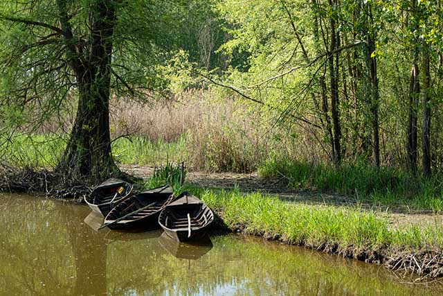
Leonardo knew the Fucecchio marsh well. From the village of Vinci, passing through San Pantaleo, one arrived in a short time to the shores of the lake. Here stood numerous landings, from where the typical marsh boats carried goods and people from one side to the other over the mirror of water. Leonardo has depicted the Fucecchio Marsh on various maps dedicated to the Lower Valdarno, including map RL 12685 from the Windsor Castle collection. Even in the well renowned Leonardian landscape of 1473 preserved in the Uffizi, it seems we can recognize, in the background, the still waters of the marsh being rippled slightly, perhaps, by a small navicello (marsh ferry).